
Who Ran Which Towns
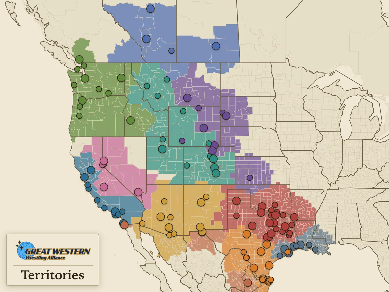
This site is a companion to the GWA Worldbook at gwawrestling.com. Two maps about North American wrestling territories. One draws the fictional Great Western Wrestling Alliance (GWA) year by year; the other draws the real promotions of the territorial era.
The maps
-
GWA Territories
1957–1993 · every year
One Texas border territory in 1957, expanding across the Western US in the second half of the 20th century. Rio Grande to Redwoods, the GWA was The Powerhouse of Pro Wrestling! See where its fortunes rose and fell, year by year.

-
Territorial Era Wrestling
1958, 1965, 1975, 1985
The real map. NWA members plus the AWA, the WWWF, and the WWA. Texas splits four ways, California north and south, and two promotions run St. Louis at once.



How to read them
Each map draws three layers. A county takes the color of whoever ran it that year: a promotion on the real map, a GWA territory on the fiction. Towns are dots, and a town two of them worked in the same year splits into wedges, one per owner. Co-promoted regions get a hatch on top.
Either map embeds in another page, framed on one year or one territory. The snippet is on each map's page.